| |
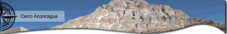
Its 6.962 meters above sea level becomes it in the highest peak in the American continent. It belongs to The Andes, precisely to the limited range that extends from north to south throughout the continent. It pours its water into the Atlantic Ocean, reason that it is not a bordering peak despite being the highest one.
It was first climbed by the Swiss guide Matias Zurbriggen on January 14, 1897. In quechua, its name means “Stone Sentinel”, probably named by the Incas. Long before, they ascent the mountains to make sacrifices and offerings, as the mummy, found in one of its slopes, indicates. It is about an eight year old boy.
It is enterely in Argentine territory, in the province of Mendoza where is the center of the Aconcagua Provincial Park. It depends on the derection of renewable natural resources and it has been turned into a nature reserve of flora, fauna and mineral deposits since 1992.
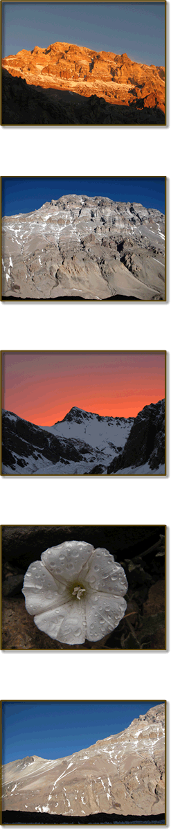
Since last years, it is the center of attraction for climbers of all levels because it has routes of diverse challenges, from its normal route, the easiest one but with a great technical difficulty, to the route that runs along the south wall. This last one is considered one of the hardest walls in the Globe (between them routes in the Nanga Parbat, the K 2, Everest, etc) by featured climbers anda expeditioners. It is also considered “the small Everest” because of its technical, logistical, strategic and climatic difficulties.
Its Routes
The hill resembles a three-sided pyramid, where you can access for to the so precious summit by different routes.
-
The northwest side: arrive from the Inca bridge, entering the Quebrada de los Horcones. When we get Confluencia, we take a path to the northwest that leaves us in the Quebrada del Rio Horcones Superior. Going trough this you get to the base camp Plaza de Mulas at 4220 meters above sea level. From there you climb the hill by its normal route. Setting up different high camps as: Plaza Canadá, Cambio de Pendiente, Nido de Cóndores, Berlín. Having these other variants where it is necessary to use rock climbong techniques.
-
The east side: presenting more difficult routes, you climb the mountain by the Polish Glacier, an extension of ice and snow that reaches more than thousand meters of unevenness. You have to use techniques of crack traffic and assurance on ice. It makes it an amazing climbing. The glacier also has different routes. You access from Punta de Vacas by the Quebrada of the Vacas river, trough the intermediate camps of Pampa de Leñas and Casa de Piedras. They are three days of about 5 hours of trekking each day to reach the base camp Plaza Argentina that is 4.300 meters above sea level.
-
The south side: the greatest difficulty. It has climbing routes with a drop of almost 3.000 meters, traveling at high altitude glaciers and rock climbing more than 6.000 meters above sea level. Ice climbing with slopes of 90 degrees. Experts only. The Plaza Francia base camp is located 4.200 meters above sea level. It is an interesting trekking to sightseeing and acclimatize.
The access to the base camp is progressive: day by day. This is why the gap to overcome from the moment of getting off a vehicle, is very large and the distance to travel by walking is around the 36 km. Some people prefer to do it in one day, mounted on a mule, but it is preferable trekking because it promotes acclimatization and you can visit Plaza Francia sighting the south side.
Programs include acclimatization and rest day. They are carefully desgned to secure more chances to reach the summit, because the acclimatization is a process of adaptation to high and each person respond in different ways. We also take into account the meteorological factor. Winds and snow can be very strong and we must expect the good weather.
The equipment is transported on mule. Otherwise the approximation would be slower. It would require several days and the sacrifice of large amounts of energy that would be best reserved for the days spent in height.
In the base, portage of provisions are made to the high camps. We rest and make treks in the area to acclimate.
|
 |
|